
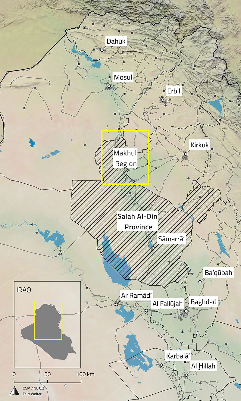
In Spring 2021, Iraq resumed the planning of the Makhul Dam project, which had been halted for twenty years. The dam is set to flood 260 km², putting over 200 archaeological sites at risk, including the UNESCO World Heritage site of ancient Ashur. To address this, an emergency documentation project was initiated by Iraqi authorities, the German Archaeological Institute, and the Foreign Office, using remote sensing and local surveys to document these sites before they are submerged.
In Spring 2022, Simone Mühl and I carried out a rescue survey at sites like Kar-Tukulti-Ninurta, located on the east bank of the Tigris River. As an Assyrian capital from the 13th century BCE, Kar-Tukulti-Ninurta is threatened by the dam, which would flood most of the site. Our work involved preliminary investigations and drone documentation to assess the site’s condition and create records that will aid in future conservation efforts.
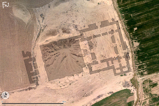
The reconstruction project began with the review and digitization of existing documentation on Kar-Tukulti-Ninurta, including early excavation records, original drawings, diaries, and more recent studies by Iraqi collegues. I gathered around 35 plans and sketches, offering varying levels of detail on the excavated buildings.
Using satellite images and our own aerial survey data, I mapped the site plans within a real-world coordinate system. An ortho-mosaic and digital terrain model from our UAV survey provided high-resolution data of key areas like the temple and palace complexes, greatly aiding in plan referencing.
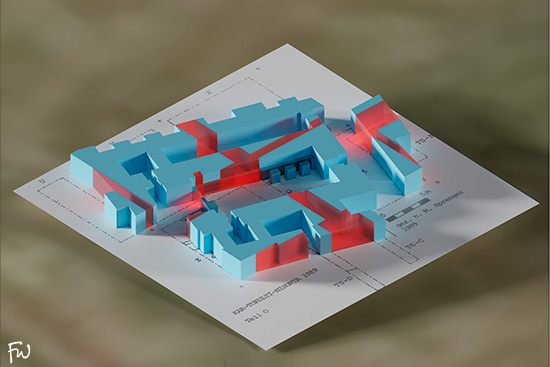
Older fieldwork and excavations at Kar-Tukulti-Ninurta proposed features like canals, city walls, and a palace, though these areas were never fully exposed. Later work built on these layouts, adding indicators of city walls. The results of my work on Kar-Tukulti-Ninurta are displayed in the interactive 3D model below. This model, created from detailed old excavation plans and recent surveys, offers an in-depth view of the site.
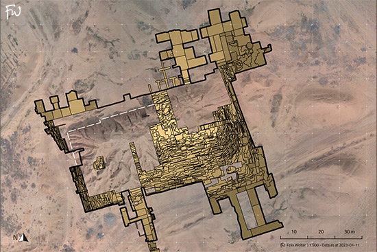
The accompanying GIS files can serve as a solid foundation for future on-site investigations and preservation efforts at Kar-Tukulti-Ninurta.
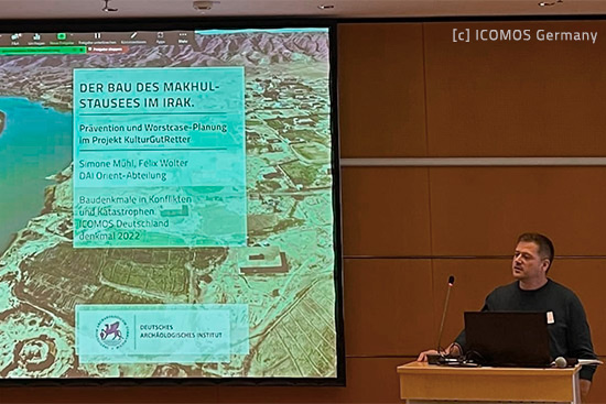
We presented the preliminary results of our fieldwork at an ICOMOS-organized international conference, "Architectural Monuments in Conflicts and Disasters: Prevention / Intervention / Recovery," held at denkmal 2022 in Leipzig. The talk offered insights into our work in the Makhul Dam area, covering preventive measures and worst-case planning scenarios.
The results were published in the following article, which also includes all sources for the reconstructions mentioned above: