About me
I am an archaeologist (M.A.) with 15 years of field work. In addition, I am a trained graphic designer. Combining these two strands, my aim is to optimize the interaction and integration of surveying and 3D documentation with the requirements of traditional excavation documentation.
To this end, I offer a range of support services for archaeological research, such as technical support in the documentation and evaluation of excavation results as well as professional execution of their presentation, publication and archiving. My knowledge of the challenges in the processing of archaeological data can help to identify and avoid labour- and cost-intensive redundancies in advance.
The use of my own up-to-date technical equipment and my many years of experience in various archaeological research projects guarantee high standards and professional handling of your data. This ensures on-time delivery of your documentation results in the form of digital data, plans, illustrations and 3D models.
Please feel free to contact me anytime with your ideas, questions or inquiries...

-
 Education and Degrees
01/2005
Media Designer for Digital and Print Media
Agency for communication design „doppelpunkt“, Berlin
2005-9
Studies of Visual Communication
weißensee Academy of Art Berlin | not finished.
01/2012
Bachelor of Arts in Near Eastern Archaeology and Anthropology
Ruprecht-Karls-Universität Heidelberg
02/2016
Master of Arts in Near Eastern Archaeology
Freie Universität Berlin
TODAY
Still learning...
-
 Archaeological Field Work
 Summer 2010
Tell Halaf Archaeological Mission (Syria)
Head of the Mission: Dr. Lutz Martin (VAM Berlin)
Tasks: Small find drawingSummer 2011
Bakr Awa Archaeological Mission (Iraqi Kurdistan)
Head of the Mission: Dr. Peter Miglus (RKU Heidelberg)
Tasks: Trench assistance, Surveying, Small find drawingSummer 2012
Shahrizor Survey Project (Iraqi Kurdistan)
Head of the Mission: Dr. Simone Mühl (LMU Munich)
Tasks: Surveying, Pottery recording and documentationSummer 2013
Dekon Rescue Excavation (Iraqi Kurdistan)
Head of the Mission: Zohair R. Abdullah al-Samarraee (Gov. Suleymania)
Tasks: Trench assistance, Surveying and DocumentationSummer 2013
Shahrizor Survey Project (Iraqi Kurdistan)
Head of the Mission: Dr. Simone Mühl (LMU Munich)
Tasks: Surveying, Pottery recording and documentationSpring 2014
Shahrizor Survey Project (Iraqi Kurdistan)
Head of the Mission: Dr. Simone Mühl (LMU Munich)
Tasks: Find recording, Pottery drawingSpring 2015
Shamlu Archaeological Mission (Iraqi Kurdistan)
Read more about the Shamlu Archaeological Mission Head of the Mission: Dr. Simone Mühl (LMU Munich)
Tasks: Trench assistance, Surveying and DocumentationSummer 2015
Shahrizor Survey Project Iraqi Kurdistan
Head of the Mission: Dr. Simone Mühl (LMU Munich), Dr. Manfred Rösch, Dr. Annette Kadereit
Tasks: Core sampling assistanceSummer 2016
Shamlu Archaeological Mission (Iraqi Kurdistan)
Read more about the Shamlu Archaeological Mission Head of the Mission: Dr. Simone Mühl (LMU Munich)
Tasks: Trench supervision, Surveying and DocumentationSpring 2017
Peshdar Plain Project (Iraqi Kurdistan)
Read more about the Peshdar Plain Project Head of the Mission: Dr. Karen Radner (LMU Munich), Dr. Janoscha Kreppner (WWU Münster)
Tasks: Trench supervision, Surveying and DocumentationSummer 2017
Shamlu Archaeological Mission (Iraqi Kurdistan)
Read more about the Shamlu Archaeological Mission Head of the Mission: Dr. Simone Mühl (LMU Munich)
Tasks: Trench supervision, Surveying and DocumentationSpring 2018
Peshdar Plain Project (Iraqi Kurdistan)
Read more about the Peshdar Plain Project Head of the Mission: Dr. Karen Radner (LMU Munich), Dr. Janoscha Kreppner (WWU Münster)
Tasks: Trench supervision, Surveying and DocumentationSummer 2018
Shamlu Archaeological Mission (Iraqi Kurdistan)
Read more about the Shamlu Archaeological Mission Head of the Mission: Dr. Simone Mühl (LMU Munich)
Tasks: Trench supervision, Surveying and DocumentationSpring 2019
Shamlu Archaeological Mission (Iraqi Kurdistan)
Read more about the Shamlu Archaeological Mission Head of the Mission: Dr. Simone Mühl (LMU Munich)
Tasks: Trench supervision, Surveying and DocumentationSpring 2020
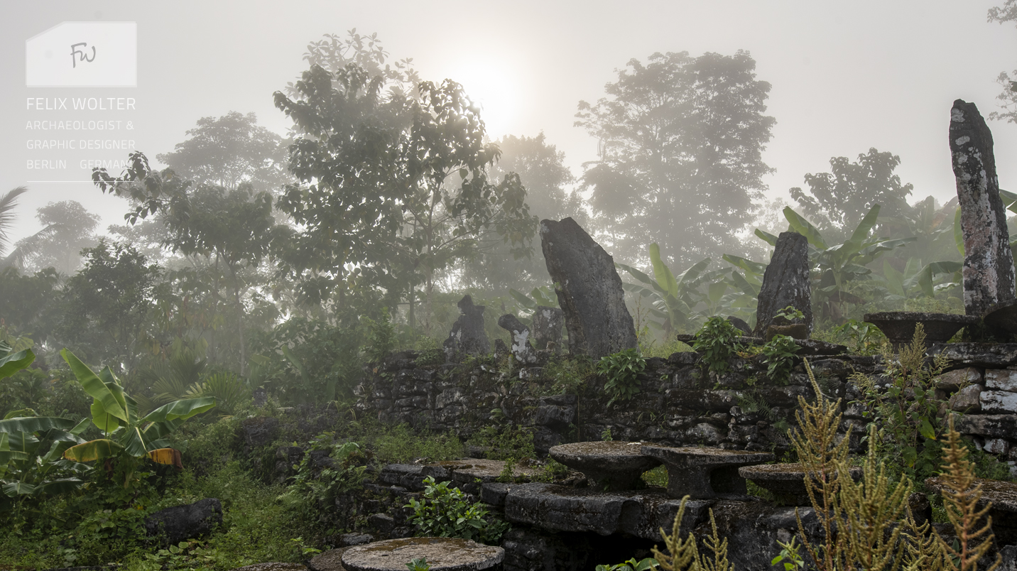
Telling Stones Megalith Project (Nias Island / Indonesia)
Read more about the Telling Stones Megalith ProjectHead of the Mission: Prof. Dr. Dominik Bonatz (FU Berlin)
Tasks: 3D-recording, Topography and MappingSummer 2020
Former "Kaiser Wilhelm Institut" (Berlin, Germany)
Head of the Mission: Prof. Dr. Susan Pollock (FU Berlin)
Tasks: Localization, 3D-recording and Surveying.Autumn 2020
Einsatzlager Wustrau (Brandenburg, Germany)
Read more about the Wustrau Excavations Head of the Mission: Prof. Dr. Reinhard Bernbeck (FU Berlin)
Tasks: Localization, 3D-recording and Surveying.Summer 2021
Tell Ushayer Excavations (Jordan)
Read more about the Ushayer Excavations Head of the Mission: Prof. Dr. Dominik Bonatz (FU Berlin)
Tasks: Topography, 3D-recording and Surveying.Autumn 2021
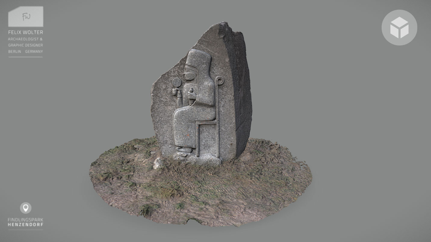
Iron Age Statues Documentation Project (Jordan)
Head of the Project: Dr. Katharina Schmidt (GPIA Amman)
Tasks: 3D-Documentation & Handdrawings.Spring 2022
Makhul Dam Rescue Project (Iraq)
Head of the Project: Dr. Simone Mühl (DAI Berlin)
Tasks: Topography, 3D-recording and Surveying.Qala Shila Excavation Project (Iraqi Kurdistan)
Read more about the Qala Shila Excavations Head of the Project: Dr. Cinzia Pappi (ASK Project / FU Berlin)
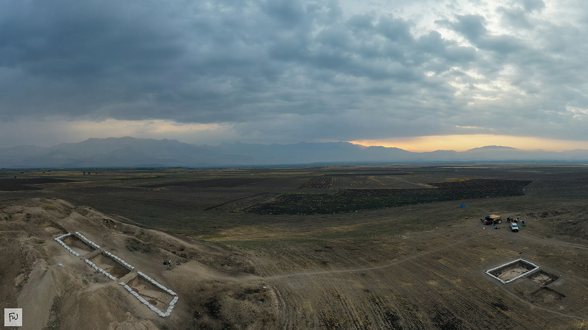
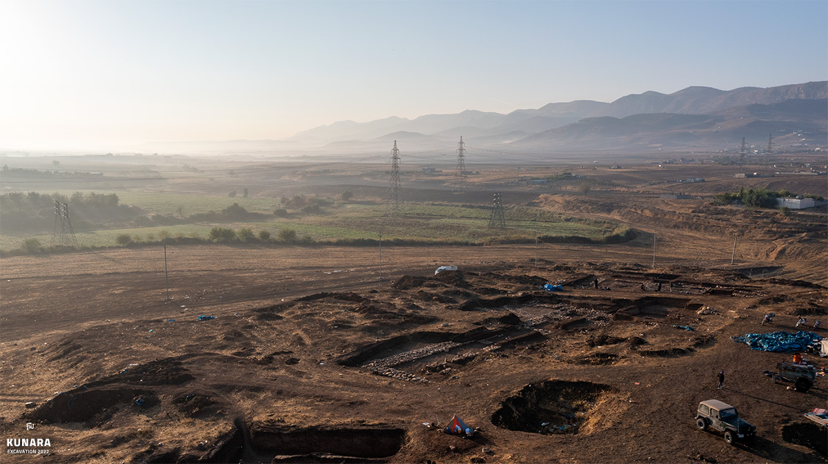
Tasks: Topography, 3D-recording and Surveying.Kunara Excavation Project (Iraqi Kurdistan)
Read more about the Kunara Excavations Head of the Project: Dr. Aline Tenu (CNRS / France)
Tasks: Small find drawing and 3D-recording of objects.Summer 2022
Tell Ushayer Excavations (Jordan)
Read more about the Tell Ushayer Excavations Head of the Mission: Prof. Dr. Dominik Bonatz (FU Berlin)
Tasks: Topography, 3D-recording and Surveying.Gird-i Begum Excavations (Iraqi Kurdistan)
Head of the Mission: Prof. Dr. S. Pollock, R. Bernbeck (FU Berlin)
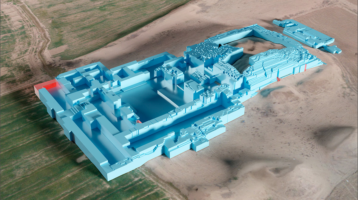
Tasks: Topography, 3D-recording and Surveying.Tell Kunara Excavations (Iraqi Kurdistan)
Read more about the Kunara Excavations Head of the Mission: Dr. Aline Tenu (CNRS / France)
Tasks: Topography and 3D-recording of Architecture.Spring 2023
Telling Stones Megalith Project (Nias Island / Indonesia)
Head of the Mission: Prof. Dr. Dominik Bonatz (FU Berlin)
Tasks: 3D-recording, Topography and MappingAutumn 2023
Gird-i Begum Excavations (Iraqi Kurdistan)
Head of the Mission: Prof. Dr. Susan Pollock, Reinhard Bernbeck (FU Berlin)
Tasks: Topography, 3D-recording and Surveying.Spring 2024
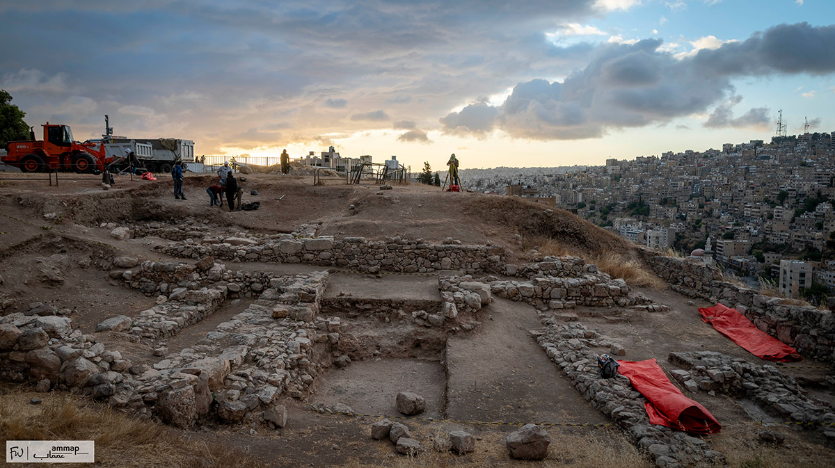
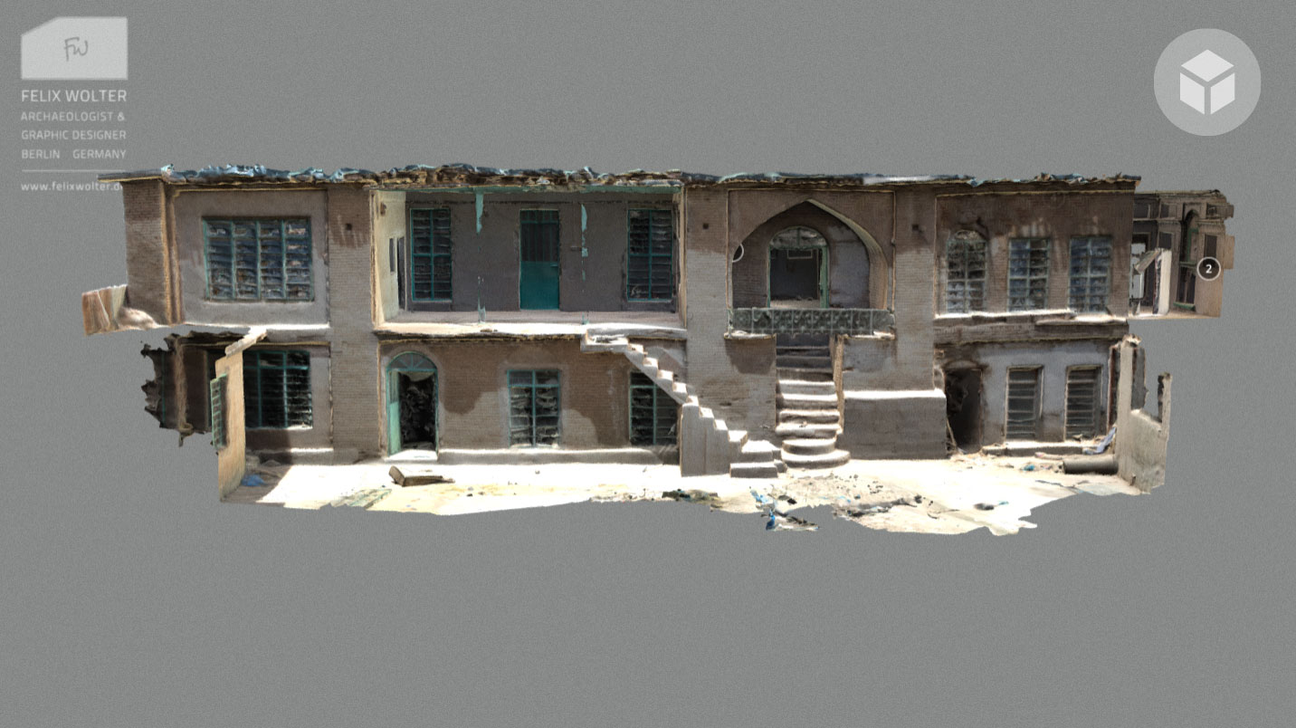
Amman Citadel Excavations (Jordan)
Head of the Mission: Prof. Dr. Katharina Schmidt (Münster Unversity | DAI)
Tasks: Vize Head of Mission, Database, Topography, 3D-recording and Surveying.Summer 2024
Tell Ushayer Excavations (Jordan)
Read more about the Tell Ushayer Excavations Head of the Mission: Dr. Nathalie Kallas | Prof. Dr. Dominik Bonatz (FU Berlin)
Tasks: Topography, 3D-recording and Surveying.Autumn 2024
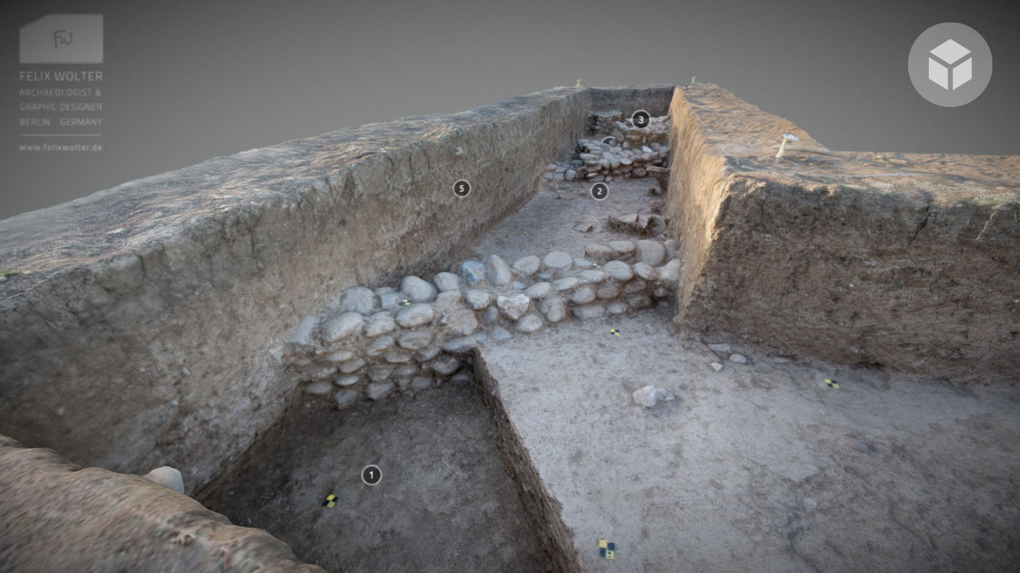
Gird-i Qalrakh | Gird-i Khazaw Excavations (Iraqi Kurdistan)
Head of the Mission: Dr. Alexander Tamm | Prof. Dr. Dirk Wicke (GU Frankfurt)
Tasks: Topography, 3D-recording and Surveying.Gird-i Begum Excavations (Iraqi Kurdistan)
Head of the Mission: Prof. Dr. Susan Pollock, Reinhard Bernbeck (FU Berlin)
Tasks: Topography, 3D-recording and Surveying.Spring 2025
Kani Shaie Excavations (Iraqi Kurdistan)
Head of the Mission: Prof. Dr. Steve Renette (University of Cambridge))
Tasks: structured-light-scanning and recording of clay sealings.Amman Citadel Excavations (Jordan)
Head of the Mission: Prof. Dr. Katharina Schmidt (Münster Unversity | DAI)
Tasks: Vize Head of Mission, Database, Topography, 3D-recording and Surveying.The Future
I originally trained in visual communication before earning my BA in Near Eastern Archaeology and Anthropology at Heidelberg and completing an MA in Near Eastern Archaeology at Freie Universität Berlin.
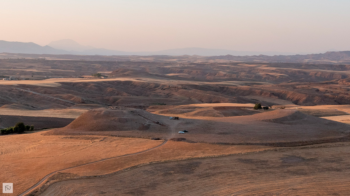
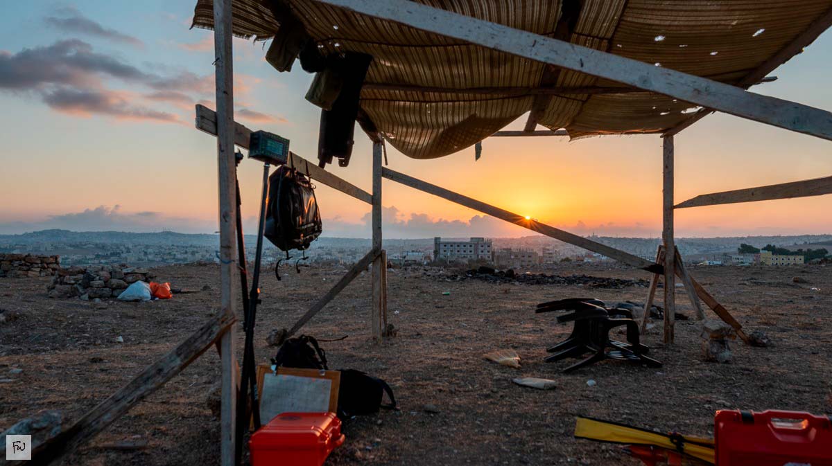
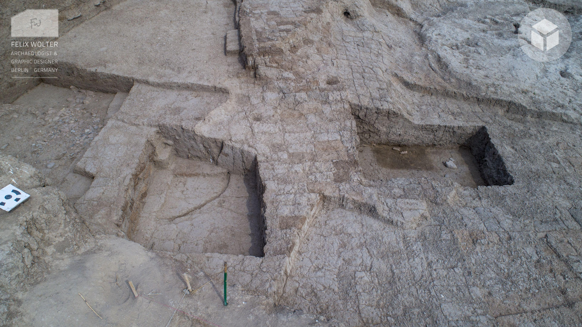
So far, I’ve taken part in 29 field missions, working with teams from 11 universities and institutes across the Middle East, Southeast Asia, and Europe. My core focus has been on topographic surveying and 3D documentation, with a growing role in project coordination and leadership.
 3D Archaeology and Graphic Design
 3D Archaeology and Graphic Design